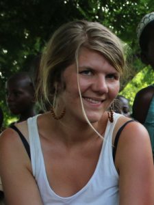
 Dr. Emma is currently pursuing a three-year postdoc project entitled “Visualizing the future – charting pathways for sustainable development with participatory art and scenario thinking”, which will be based at the DAECD at Sokoine University of Agriculture in Tanzania. The program also involves visits at LUCSUS at Lund University, and IFRO at Copenhagen University. She is a physical geographer and sustainability scientist with an interest to develop and apply interdisciplinary research approaches to understand complex sustainability challenges.
The three-year postdoc project aims to combine and develop methods of participatory art and scenario thinking to generate viable future visions, and a range of pathways for development. She has also developed visions in the Swedish context of farming and carbon sequestration, and will continue to focus on how to scale up agroecological initiatives in Tanzania. The ultimate purpose of using art in the scenario process is to create viable development pathways based on local concerns and aspirations, and as a communication tool for presenting challenges and opportunities under different futures.
Previously, she was engaged in a research project where she estimated changes in terrestrial carbon in Cambodia. Cambodia is a country that is experiencing rapid and extensive deforestation that can be partly linked to land grabbing. She mapped the changes in carbon pools in space and through time, and also mapped where the carbon loss is virtually export. For her PhD thesis she applied mixed methods to analyze ‘land grabbing’ from a global to local scale. The global to continental scale of analysis is quantitative and relates to the global connectivity of land acquisitions and changes in water supply and demand, while the local studies are qualitative and use participatory art to understand local perceptions of socio-environmental change, and future aspirations for change.
Teaching
Her teaching generally focuses on quantitative tools and methods related to geographies of change. But more recenty she has been the course coordinator for the LUMES course Earth Systems Science, which is a bridge beween key concepts in physical geography and how such knowledge is important for sustainability science. She has also held several lectures about participatory methods and the use of art. Below is a selection of courses that she has been teaching over the past 4 years.
- Course coordinator for Earth Systems Science course in the LUMES programme, 2020
- Spatial Analysis (Introduction to R, clustering, point patterns), 2017, 2019
- Land surface processes and landscape dynamics (lecture about land grabbing, and exercise about land grabbing in Uganda), 2019
- Geografisk informationsteknik (Vector analysis), 2019
- Theory and methods in physical geography (introduction to Excel, System Modelling), 2019
- GIS and climate change (online), 2019
- Geographical Information Systems, Introduction (online), 2019
- Environmental Studies and Sustainability Science: Concepts, Challenges and Approaches in Sustainability Studies (Big data and sustainability), 2018
- Sustainability Science (Participatory research), 2018
- LUMES Methods Seminars (Quantitative methods), 2018
Scientific Illustrations
She also have a particular interest of visualizing science as graphs, maps, paintings, and even stop-motion movies. A nice illustration is a good and efficient way to catch someone’s attention and communicate your scientific results. She is part time freelancing as a science illustrator, so if you need help with tables, charts, figures, maps, or other visualizations, don’t hesitate to contact her at [click here].
